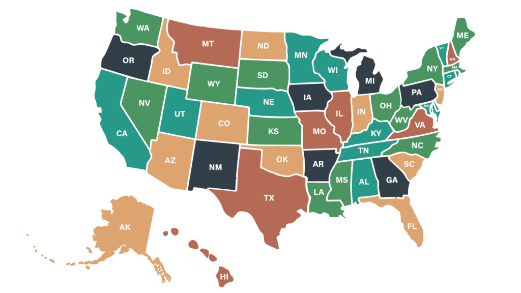
Interactive Map of States
There are nearly 3,000 conservation districts across the country, and each one works to promote healthy soils, water, forests, and wildlife. Understanding your state’s laws, organization structure, funding models, and terminology will help you navigate more confidently as a new employee.
Use this map to get familiar with your state and the surrounding region. As you explore, you’ll see how conservation districts are organized and which agency provides state-level support. Each linked website offers valuable insight to help you get oriented to the laws, structures, and priorities unique to your state.
Click a plus icon to view information for a state. Click again to close.

Alabama
- District name: Soil & Water Conservation Districts
- Number of districts: 67
- State level office: Alabama Soil & Water Conservation Committee
- District association: alconservationdistricts.org
Alaska
- District name: Soil & Water Conservation Districts
- Number of districts: 12
- State level office: Alaska Department of Natural Resources
- District association: https://alaskaconservationdistricts.org/
Arizona
- District name: Natural Resource Conservation Districts
- Number of districts: 42
- State level office: Arizona State Land Department
- District association: https://www.aacd1944.com/
Arkansas
- District name: Conservation Districts
- Number of districts: 75
- State level office: Arkansas Natural Resources Commission
- District association: https://aracd.org/
California
- District name: Resource Conservation Districts
- Number of districts: 96
- State level office: California Department of Conservation
- District association: https://carcd.org/
Colorado
- District name: Conservation Districts
- Number of districts: 74
- State level office: Colorado Conservation Services Division
- District association: https://coloradoacd.org/
Connecticut
- District name: Soil & Water Conservation Districts
- Number of districts: 5
- State level office: Connecticut Council on Soil and Water Conservation
- District association: https://www.conservect.org/
Delaware
- District name: Soil & Water Conservation Districts
- Number of districts: 3
- State level office: Department of Natural Resources and Environmental Control
- District association: https://dacdnet.org/
Florida
- District name: Soil & Water Conservation Districts
- Number of districts: 58
- State level office: Florida Office of Agricultural Water Policy
- District association: https://www.afcd.us/
Georgia
- District name: Soil & Water Conservation Districts
- Number of districts: 40
- State level office: Georgia Soil and Water Conservation Commission
- District association: https://www.gacd.us/
Hawaii
- District name: Soil & Water Conservation Districts
- Number of districts: 16
- State level office: Hawaii Department of Land and Natural Resources
- District association: https://dlnr.hawaii.gov/swcd/
Idaho
- District name: Soil Conservation Districts
- Number of districts: 50
- State level office: Idaho Soil and Water Conservation Commission
- District association: https://www.iascd.org/
Illinois
- District name: Soil & Water Conservation Districts
- Number of districts: 100
- State level office: Illinois Land & Water Resources
- District association: http://www.aiswcd.org/
Indiana
- District name: Soil & Water Conservation Districts
- Number of districts: 92
- State level office: Indiana State Department of Agriculture - Soil Conservation
- District association: https://iaswcd.org/
Iowa
- District name: Soil & Water Conservation Districts
- Number of districts: 100
- State level office: Iowa Division of Soil Conservation & Water Quality
- District association: https://cdiowa.org/
Kansas
- District name: Conservation Districts
- Number of districts: 105
- State level office: Kansas Division of Conservation
- District association: kacdnet.org
Kentucky
- District name: Conservation Districts
- Number of districts: 121
- State level office: Kentucky Division of Conservation
- District association: https://www.kyconservation.com/
Louisiana
- District name: Soil & Water Conservation Districts
- Number of districts: 44
- State level office: Louisiana Soil & Water Conservation
- District association: https://www.ldaf.la.gov/land/conservation/soil-and-water-conservation-districts
Maine
- District name: Soil & Water Conservation Districts
- Number of districts: 16
- State level office: Maine Department of Agriculture, Conservation and Forestry
- District association: https://www.maineconservationdistricts.org/
Maryland
- District name: Soil Conservation Districts
- Number of districts: 24
- State level office: Maryland Department of Resource Conservation
- District association: https://mascd.net/
Massachusetts
- District name: Soil & Water Conservation Districts
- Number of districts: 13
- State level office: Massachusetts Department of Conservation & Recreation
- District association: https://massacd.org/
Michigan
- District name: Conservation Districts
- Number of districts: 75
- State level office: Michigan Department of Agriculture & Rural Development
- District association: https://www.macd.org/
Minnesota
- District name: Soil & Water Conservation Districts
- Number of districts: 88
- State level office: Minnesota Board of Water and Soil Resources
- District association: https://www.maswcd.org/
Mississippi
- District name: Soil & Water Conservation Districts
- Number of districts: 82
- State level office: Mississippi Soil & Water Conservation Commission
- District association: Mississippi Association of Conservation Districts
Missouri
- District name: Soil & Water Conservation Districts
- Number of districts: 114
- State level office: Missouri Department of Natural Resources
- District association: https://www.moswcd.com/
Montana
- District name: Conservation Districts
- Number of districts: 58
- State level office: Montana Department of Natural Resources & Conservation
- District association: https://macdnet.org/
Nebraska
- District name: Natural Resources Districts
- Number of districts: 23
- State level office: Nebraska Department of Natural Resources
- District association: https://www.nrdnet.org/
Nevada
- District name: Conservation Districts
- Number of districts: 28
- State level office: Nevada Department of Conservation & Natural Resources
- District association: https://www.nvacd.org/
New Hampshire
- District name: Soil & Water Conservation Districts
- Number of districts: 10
- State level office: New Hampshire State Conservation Committee
- District association: https://www.nhacd.net/
New Jersey
- District name: Soil Conservation Districts
- Number of districts: 13
- State level office: New Jersey Agricultural and Natural Resources
- District association: https://www.njacd.org/
New Mexico
- District name: Soil & Water Conservation Districts
- Number of districts: 47
- State level office: New Mexico Department of Agriculture
- District association: https://www.nmacd.org/
New York
- District name: Soil & Water Conservation Districts
- Number of districts: 58
- State level office: New York State Soil & Water Conservation Committee
- District association: https://www.nyacd.org/
North Carolina
- District name: Soil & Water Conservation Districts
- Number of districts: 96
- State level office: North Carolina Division of Soil & Water Conservation
- District association: https://ncaswcd.org/
North Dakota
- District name: Soil Conservation Districts
- Number of districts: 54
- State level office: North Dakota State Soil Conservation Committee
- District association: https://www.ndascd.com/
Ohio
- District name: Soil & Water Conservation Districts
- Number of districts: 88
- State level office: Ohio Division of Soil and Water Conservation
- District association: https://ofswcd.org/
Oklahoma
- District name: Conservation Districts
- Number of districts: 84 state, 5 tribal
- State level office: Oklahoma Conservation Commission
- District association: https://www.okconservation.org/
Oregon
- District name: Soil & Water Conservation Districts
- Number of districts: 45
- State level office: Oregon Natural Resources Division
- District association: https://www.oacd.org/
Pennsylvania
- District name: Soil & Water Conservation Districts
- Number of districts: 66
- State level office: Pennsylvania State Conservation Commission
- District association: https://pacd.org/
Rhode Island
- District name: Soil & Water Conservation Districts
- Number of districts: 3
- State level office: Rhode Island State Conservation Committee
- District association: https://www.riacd.org/
South Carolina
- District name: Soil & Water Conservation Districts
- Number of districts: 46
- State level office: South Carolina Land, Water & Conservation Division
- District association: https://scacd.org/
South Dakota
- District name: Conservation Districts
- Number of districts: 68
- State level office: South Dakota Department of Conservation & Forestry
- District association: https://www.sdconservation.org/
Tennessee
- District name: Soil Conservation Districts
- Number of districts: 95
- State level office: Tennessee Land & Water Stewardship
- District association: http://tnacd.org/
Texas
- District name: Soil & Water Conservation Districts
- Number of districts: 216
- State level office: Texas State Soil & Water Conservation Board
- District association: https://www.atswcd.org/
Utah
- District name: Soil Conservation Districts
- Number of districts: 38
- State level office: Utah Conservation Division
- District association: https://www.uacd.org/
Vermont
- District name: Natural Resource Conservation Districts
- Number of districts: 14
- State level office: Vermont Department of Environmental Conservation
- District association: https://www.vacd.org/
Virginia
- District name: Soil & Water Conservation Districts
- Number of districts: 47
- State level office: Virginia Department of Conservation and Recreation
- District association: https://vaswcd.org/
Washington
- District name: Conservation Districts
- Number of districts: 45
- State level office: Washington State Conservation Commission
- District association: https://www.wadistricts.org/
West Virginia
- District name: Soil & Water Conservation Districts
- Number of districts: 14
- State level office: West Virginia Conservation Agency
- District association: https://www.wvca.us/
Wisconsin
- District name: Land Conservation Departments
- Number of districts: 72
- State level office: Wisconsin Bureau of Land and Water Resource Management
- District association: http://www.wlwca.org/
Wyoming
- District name: Conservation Districts
- Number of districts: 34
- State level office: Wyoming Department of Natural Resources & Policy
- District association: https://conservewy.com/
Alabama
- District name: Soil & Water Conservation Districts
- Number of districts: 67
- State level office: Alabama Soil & Water Conservation Committee
- District association: alconservationdistricts.org
Alaska
- District name: Soil & Water Conservation Districts
- Number of districts: 12
- State level office: Alaska Department of Natural Resources
- District association: https://alaskaconservationdistricts.org/
Arizona
- District name: Natural Resource Conservation Districts
- Number of districts: 42
- State level office: Arizona State Land Department
- District association: https://www.aacd1944.com/
Arkansas
- District name: Conservation Districts
- Number of districts: 75
- State level office: Arkansas Natural Resources Commission
- District association: https://aracd.org/
California
- District name: Resource Conservation Districts
- Number of districts: 96
- State level office: California Department of Conservation
- District association: https://carcd.org/
Colorado
- District name: Conservation Districts
- Number of districts: 74
- State level office: Colorado Conservation Services Division
- District association: https://coloradoacd.org/
Connecticut
- District name: Soil & Water Conservation Districts
- Number of districts: 5
- State level office: Connecticut Council on Soil and Water Conservation
- District association: https://www.conservect.org/
Delaware
- District name: Soil & Water Conservation Districts
- Number of districts: 3
- State level office: Department of Natural Resources and Environmental Control
- District association: https://dacdnet.org/
Florida
- District name: Soil & Water Conservation Districts
- Number of districts: 58
- State level office: Florida Office of Agricultural Water Policy
- District association: https://www.afcd.us/
Georgia
- District name: Soil & Water Conservation Districts
- Number of districts: 40
- State level office: Georgia Soil and Water Conservation Commission
- District association: https://www.gacd.us/
Hawaii
- District name: Soil & Water Conservation Districts
- Number of districts: 16
- State level office: Hawaii Department of Land and Natural Resources
- District association: https://dlnr.hawaii.gov/swcd/
Idaho
- District name: Soil Conservation Districts
- Number of districts: 50
- State level office: Idaho Soil and Water Conservation Commission
- District association: https://www.iascd.org/
Illinois
- District name: Soil & Water Conservation Districts
- Number of districts: 100
- State level office: Illinois Land & Water Resources
- District association: http://www.aiswcd.org/
Indiana
- District name: Soil & Water Conservation Districts
- Number of districts: 92
- State level office: Indiana State Department of Agriculture – Soil Conservation
- District association: https://iaswcd.org/
Iowa
- District name: Soil & Water Conservation Districts
- Number of districts: 100
- State level office: Iowa Division of Soil Conservation & Water Quality
- District association: https://cdiowa.org/
Kansas
- District name: Conservation Districts
- Number of districts: 105
- State level office: Kansas Division of Conservation
- District association: kacdnet.org
Kentucky
- District name: Conservation Districts
- Number of districts: 121
- State level office: Kentucky Division of Conservation
- District association: https://www.kyconservation.com/
Louisiana
- District name: Soil & Water Conservation Districts
- Number of districts: 44
- State level office: Louisiana Soil & Water Conservation
- District association: https://www.ldaf.la.gov/land/conservation/soil-and-water-conservation-districts
Maine
- District name: Soil & Water Conservation Districts
- Number of districts: 16
- State level office: Maine Department of Agriculture, Conservation and Forestry
- District association: https://www.maineconservationdistricts.org/
Maryland
- District name: Soil Conservation Districts
- Number of districts: 24
- State level office: Maryland Department of Resource Conservation
- District association: https://mascd.net/
Massachusetts
- District name: Soil & Water Conservation Districts
- Number of districts: 13
- State level office: Massachusetts Department of Conservation & Recreation
- District association: https://massacd.org/
Michigan
- District name: Conservation Districts
- Number of districts: 75
- State level office: Michigan Department of Agriculture & Rural Development
- District association: https://www.macd.org/
Minnesota
- District name: Soil & Water Conservation Districts
- Number of districts: 88
- State level office: Minnesota Board of Water and Soil Resources
- District association: https://www.maswcd.org/
Mississippi
- District name: Soil & Water Conservation Districts
- Number of districts: 82
- State level office: Mississippi Soil & Water Conservation Commission
- District association: Mississippi Association of Conservation Districts
Missouri
- District name: Soil & Water Conservation Districts
- Number of districts: 114
- State level office: Missouri Department of Natural Resources
- District association: https://www.moswcd.com/
Montana
- District name: Conservation Districts
- Number of districts: 58
- State level office: Montana Department of Natural Resources & Conservation
- District association: https://macdnet.org/
Nebraska
- District name: Natural Resources Districts
- Number of districts: 23
- State level office: Nebraska Department of Natural Resources
- District association: https://www.nrdnet.org/
Nevada
- District name: Conservation Districts
- Number of districts: 28
- State level office: Nevada Department of Conservation & Natural Resources
- District association: https://www.nvacd.org/
New Hampshire
- District name: Soil & Water Conservation Districts
- Number of districts: 10
- State level office: New Hampshire State Conservation Committee
- District association: https://www.nhacd.net/
New Jersey
- District name: Soil Conservation Districts
- Number of districts: 13
- State level office: New Jersey Agricultural and Natural Resources
- District association: https://www.njacd.org/
New Mexico
- District name: Soil & Water Conservation Districts
- Number of districts: 47
- State level office: New Mexico Department of Agriculture
- District association: https://www.nmacd.org/
New York
- District name: Soil & Water Conservation Districts
- Number of districts: 58
- State level office: New York State Soil & Water Conservation Committee
- District association: https://www.nyacd.org/
North Carolina
- District name: Soil & Water Conservation Districts
- Number of districts: 96
- State level office: North Carolina Division of Soil & Water Conservation
- District association: https://ncaswcd.org/
North Dakota
- District name: Soil Conservation Districts
- Number of districts: 54
- State level office: North Dakota State Soil Conservation Committee
- District association: https://www.ndascd.com/
Ohio
- District name: Soil & Water Conservation Districts
- Number of districts: 88
- State level office: Ohio Division of Soil and Water Conservation
- District association: https://ofswcd.org/
Oklahoma
- District name: Conservation Districts
- Number of districts: 84 state, 5 tribal
- State level office: Oklahoma Conservation Commission
- District association: https://www.okconservation.org/
Oregon
- District name: Soil & Water Conservation Districts
- Number of districts: 45
- State level office: Oregon Natural Resources Division
- District association: https://www.oacd.org/
Pennsylvania
- District name: Soil & Water Conservation Districts
- Number of districts: 66
- State level office: Pennsylvania State Conservation Commission
- District association: https://pacd.org/
Rhode Island
- District name: Soil & Water Conservation Districts
- Number of districts: 3
- State level office: Rhode Island State Conservation Committee
- District association: https://www.riacd.org/
South Carolina
- District name: Soil & Water Conservation Districts
- Number of districts: 46
- State level office: South Carolina Land, Water & Conservation Division
- District association: https://scacd.org/
South Dakota
- District name: Conservation Districts
- Number of districts: 68
- State level office: South Dakota Department of Conservation & Forestry
- District association: https://www.sdconservation.org/
Tennessee
- District name: Soil Conservation Districts
- Number of districts: 95
- State level office: Tennessee Land & Water Stewardship
- District association: http://tnacd.org/
Texas
- District name: Soil & Water Conservation Districts
- Number of districts: 216
- State level office: Texas State Soil & Water Conservation Board
- District association: https://www.atswcd.org/
Utah
- District name: Soil Conservation Districts
- Number of districts: 38
- State level office: Utah Conservation Division
- District association: https://www.uacd.org/
Vermont
- District name: Natural Resource Conservation Districts
- Number of districts: 14
- State level office: Vermont Department of Environmental Conservation
- District association: https://www.vacd.org/
Virginia
- District name: Soil & Water Conservation Districts
- Number of districts: 47
- State level office: Virginia Department of Conservation and Recreation
- District association: https://vaswcd.org/
Washington
- District name: Conservation Districts
- Number of districts: 45
- State level office: Washington State Conservation Commission
- District association: https://www.wadistricts.org/
West Virginia
- District name: Soil & Water Conservation Districts
- Number of districts: 14
- State level office: West Virginia Conservation Agency
- District association: https://www.wvca.us/
Wisconsin
- District name: Land Conservation Departments
- Number of districts: 72
- State level office: Wisconsin Bureau of Land and Water Resource Management
- District association: http://www.wlwca.org/
Wyoming
- District name: Conservation Districts
- Number of districts: 34
- State level office: Wyoming Department of Natural Resources & Policy
- District association: https://conservewy.com/
Territories
To learn more about conservation in territories, visit the links below:
Territory Conservation Districts on the Web
- American Samoa
- Federated States of Micronesia
- Guam
- Northern Mariana Islands
- Palau
- Puerto Rico
- Virgin Islands
Find a NASCA Representative
Visit the NASCA website to find the represenative for your state or territory.